Navigation is one of humanity's oldest intellectual achievements. For tens of thousands of years, the ability to travel purposefully across the open ocean – without landmarks, without instruments, in conditions of genuine isolation – represented one of the most demanding cognitive challenges a human being could face. The fact that people succeeded, colonising islands in the middle of the Pacific Ocean, trading across the Indian Ocean, and eventually reaching every habitable landmass on Earth, speaks to an extraordinary combination of observation, intelligence, and courage that deserves far more recognition than it typically receives.
The story of navigation technology is essentially the story of successive improvements in our ability to answer two fundamental questions: Where am I? and Which way do I need to go? The instruments and methods developed over millennia to answer these questions – from the simplest star observations to satellite-based positioning systems accurate to centimetres – reflect the consistent human drive to reduce uncertainty and extend capability into ever more challenging environments.
Polynesian Wayfinding: Navigation Without Instruments
The greatest navigators in human history may well have been the Polynesians, who colonised the Pacific Ocean – the largest body of water on Earth – without any of the instruments that European navigators would later consider essential. Polynesian wayfinders read the stars, the swells, the winds, the flight patterns of birds, the colour of the water, the behaviour of clouds at night (islands create distinctive cloud formations that can be visible from 50 kilometres away), and subtle phosphorescence patterns to navigate with precision between island groups separated by thousands of kilometres of open ocean.
The navigational knowledge was encoded in oral traditions, in physical star compasses made of sticks and shells, and in a profound attentiveness to the natural environment that required decades of education to master. The Mau Piailug, one of the last traditional Polynesian master navigators, was able to navigate between Hawaii and Tahiti – a distance of over 4,000 kilometres – without instruments, relying entirely on traditional methods. His voyages, conducted in the late 20th century aboard the reconstructed Hawaiian canoe Hokule'a, demonstrated that this ancient knowledge was not merely historical folklore but a genuinely functional navigation system of remarkable precision.
The Magnetic Compass and the Age of Exploration
The magnetic compass, developed in China around the 11th century and adopted by Arab and European mariners in the 12th and 13th centuries, represented a transformative improvement in navigation capability. For the first time, a reliable directional reference was available regardless of weather conditions, cloud cover, or time of day. Combined with the astrolabe and later the sextant – instruments for measuring the altitude of celestial bodies above the horizon, allowing latitude determination with considerable precision – the compass enabled the systematic exploration of the world's oceans that transformed global geography, politics, and trade in the 15th and 16th centuries.
The longitude problem – the inability to determine east-west position with precision – was the great unsolved challenge of early ocean navigation and the cause of numerous maritime disasters. Ships that knew their latitude precisely could still be hundreds of miles off course in longitude, with catastrophic consequences when approaching land. The solution, eventually developed by John Harrison in the 18th century in the form of the marine chronometer, was elegant in principle: if you know the exact time at a reference longitude (Greenwich) and can measure local time from the sun's position, the difference gives you longitude. Harrison's H4 chronometer, completed in 1759, was accurate to within seconds over a six-week ocean voyage – a revolutionary instrument that made reliable global navigation genuinely possible.
Radio Navigation: The 20th Century Revolution
The development of radio navigation in the early 20th century introduced a fundamentally new approach: using signals from fixed shore-based transmitters to determine position. Systems including LORAN (Long Range Navigation) and Decca Navigator provided navigators with reliable position fixes at ranges far beyond visual landmarks, transforming the safety of commercial shipping and eventually becoming standard equipment on any serious ocean-going vessel.
RADAR – Radio Detection And Ranging – developed during World War II, added the ability to detect other vessels and coastlines in conditions of poor visibility, addressing one of the most dangerous aspects of coastal and commercial navigation. Modern marine RADAR systems, combined with AIS (Automatic Identification System) transponders that broadcast each ship's identity, position, course, and speed, have created a level of situational awareness in busy shipping lanes that was simply impossible in previous generations.
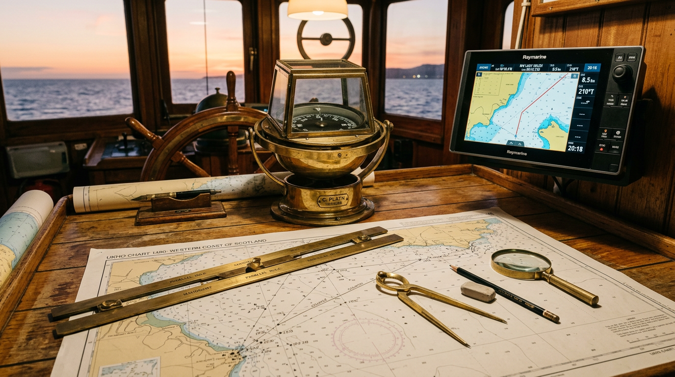
GPS and the Satellite Era
The Global Positioning System, fully operational from 1993, represents perhaps the most transformative navigation technology in history. By receiving timing signals from a constellation of satellites in medium Earth orbit and calculating the time differences between signals from multiple satellites, GPS receivers can determine position to an accuracy of a few metres – and in differential GPS systems, to centimetres. The technology is now so ubiquitous that it is taken entirely for granted, embedded in smartphones, car dashboards, and even wristwatches.
For maritime navigation, GPS combined with Electronic Chart Display and Information Systems (ECDIS) has replaced paper charts as the standard navigation tool on commercial vessels. An ECDIS system overlays vessel position and track onto digital charts, providing real-time awareness of hazards, traffic separation schemes, port approach procedures, and tidal conditions. The risk of grounding through chart-reading error – once a significant cause of maritime casualties – has been dramatically reduced.
The Future: Autonomous Navigation and AI Integration
The next frontier of navigation technology is autonomy. Autonomous and remotely operated vessels are already operating in constrained environments, and the technology for full autonomous ocean navigation is developing rapidly. AI navigation systems can process sensor data from RADAR, LIDAR, cameras, and AIS simultaneously, applying collision avoidance algorithms and route optimisation in real time at speeds far exceeding human cognitive capacity. The regulatory framework for autonomous vessels is still developing, but the International Maritime Organization (IMO) has initiated the Maritime Autonomous Surface Ships (MASS) regulatory framework process that will eventually govern these new technologies.
What remains constant through all these technological revolutions is the fundamental challenge that navigation has always presented: the need to know, with sufficient confidence to act upon, where you are and where you are going. The tools for answering these questions have evolved from star observations to satellite signals, but the intellectual and practical importance of the answer has not changed in the slightest since the first Polynesian navigator set off into an unknown ocean, reading the swells beneath the hull and the stars above the mast, in search of land that lay beyond the horizon.